PavIQ
A fleet-deployable sensor box that turns everyday buses and taxis into a continuous, city-wide road-condition survey, replacing a $26K–$105K survey run with data that updates every day.
Validated concept, fully specified, not yet built. A CAD $580 sensor box that turns buses and taxis into a continuous road-condition survey, replacing $26K–$105K survey runs. Complete hardware, firmware, and data spec with a 20-week path to a government-ready demo.
The problem
Cities manage roads with almost no real-time data
Condition surveys run once every one to three years, at CAD $26,000–$105,000 per run, or rely entirely on reactive citizen reporting. The consequences compound: emergency pothole repairs cost 3–5× more than planned maintenance, and UK motorists alone lose an estimated CAD $3 billion a year to suspension and tyre damage.
- Road authorities can't prioritise maintenance spend without objective, network-wide severity data.
- Navigation apps route without any surface-condition awareness.
- No affordable, continuously updating, city-scale dataset exists for most municipalities today.
Discovery
A supply side and a demand side
Municipal & council engineer · Buyer
Needs objective, city-wide severity data to justify infrastructure spend and shift from reactive to preventive repair.
Fleet operator · Data partner
Hosts the hardware on vehicles already driving the network daily: the free-fit offer that gets the sensor onto the road before any council contract exists.
Backlog
User stories that shaped the spec
Requirements
Spec'd as testable acceptance criteria
My role
From a $40B market claim to a buildable BOM
I sized the market, mapped the client ecosystem (municipalities, nav platforms, insurers, OEMs), and specified the full hardware and data pipeline down to individual component costs, so a technical co-founder could start ordering parts instead of debating architecture.
What I designed
A sensor box, a cloud pipeline, and three ML models
Five-sensor hardware stack
Industrial IMU + dead-reckoning GPS + barometric altimeter + wide-angle camera + 4G LTE, on a Raspberry Pi 4, in an IP65 enclosure. CAD $580 per unit.
On-device signal processing
High-pass + Kalman filtering separates real road events from vehicle body roll before anything is ever recorded.
Cloud aggregation pipeline
AWS IoT Core → PostGIS Postgres, aggregated nightly by OpenStreetMap segment ID to refresh the heatmap.
Three-model AI layer
Pothole classification (MobileNetV2), speed recommendation (XGBoost), the most commercially differentiated layer, and predictive deterioration modeling.
Under the hood
A bump becomes a graded, mapped event
Outcome
A 20-week path to a government-ready demo
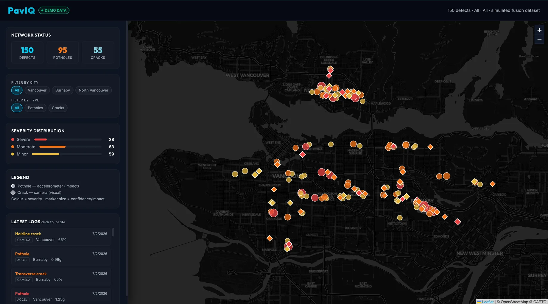
PavIQ is a complete technical spec: hardware, firmware, data pipeline, AI strategy, and a component-level bill of materials, not yet built. The plan gets from bench prototype to a five-unit fleet pilot and government-facing dashboard in 20 weeks for roughly CAD $6,100–$10,300, with a risk register already covering the failure modes (SD-card wear, GPS loss, mounting noise) that typically kill field hardware.
Roadmap
Three phases, 20 weeks
Bench prototype: integrate every sensor, validate a clean simultaneous JSON log.
Vehicle validation: four weeks of daily driving, 200+ labelled events, first Mapbox heatmap.
Fleet pilot: five units on a taxi operator, city-scale data, council-facing demo.
More case studies
Want a discovery sprint or a prototype like this one for your product? Book a call.